
A week in Serbia's mountains, away from the well-known hiking areas? Exploring waterfalls, watching butterflies flutter in secluded mountain meadows and unwinding in the evening at a mountain hut - if that doesn't sound like the perfect adventure vacation, I don't know what does!
„"These mountains have a particularly peaceful atmosphere," my friend Stefan tells me when I tell him that„, erzählt mein Freund Stefan, als ich ihm berichte, dass mich Experience Serbia has invited me to go hiking for a week in the very east of the country, on the "old mountains", the Stara Planina. Of course, I was immediately curious!
And spoiler: I loved it.
In this article, I'll tell you exactly what was so great, where the most beautiful spots are and the best tips for hiking in Serbia on the Stara Planina.
Jump directly to ↓
Route: Hiking holiday in Serbia for 6 days
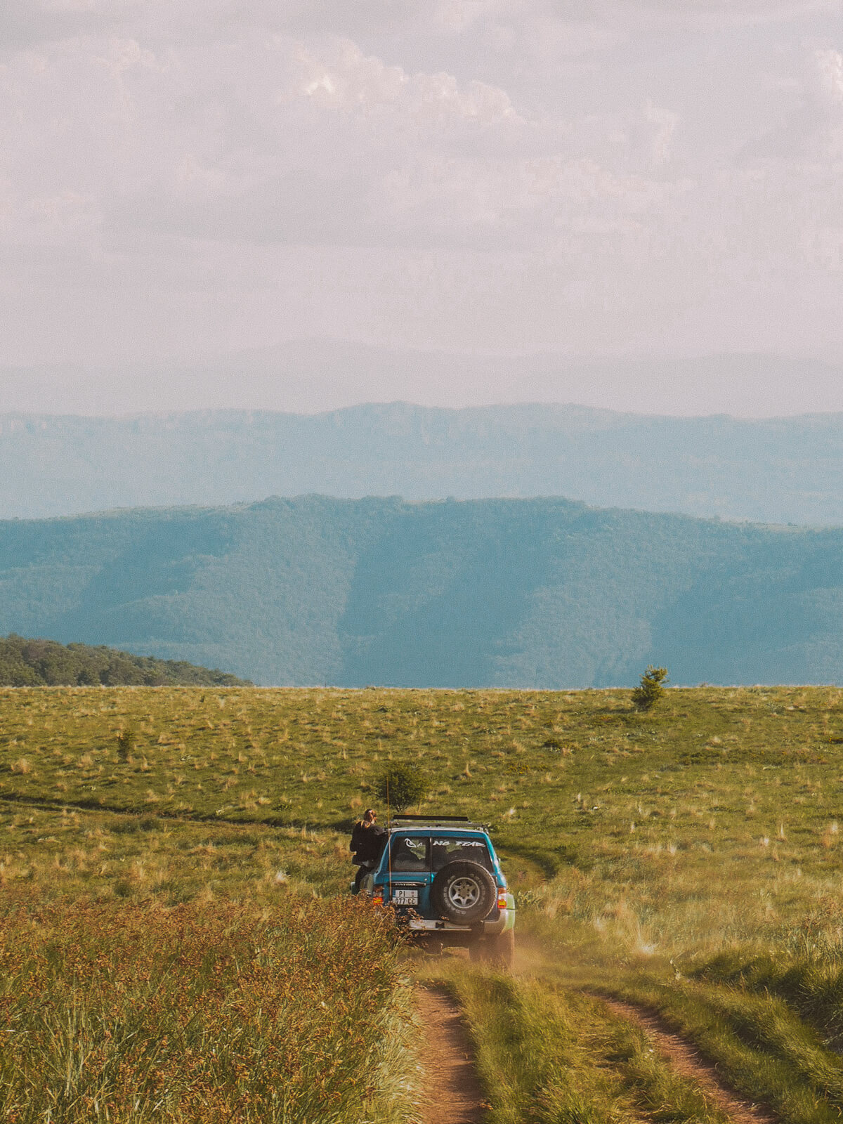
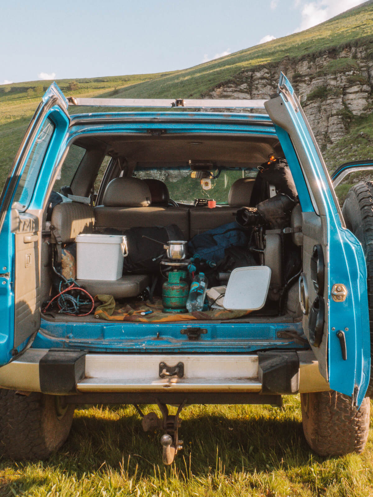
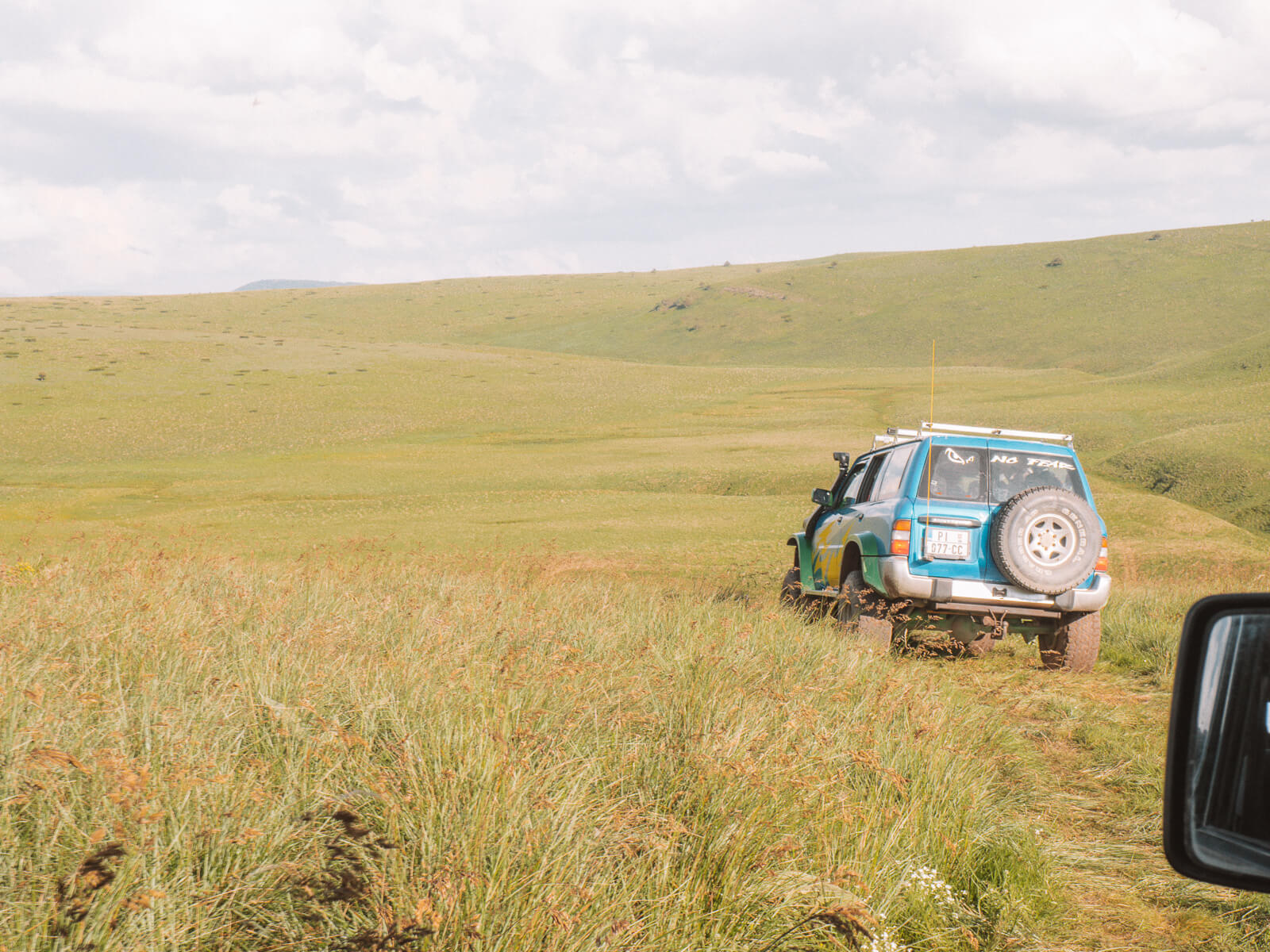
For six days, we drive through the unspoilt mountains in jeeps and start our hikes from starting points in the middle of nowhere – cell phone reception non-existent. Over gravel roads, past high meadows, we hike to the most beautiful cascading waterfalls, eat the best meals in mountain villages and make our way through caves. And this is what our route looks like with the perfect mix of adventure and relaxation in nature:
Day 1: Niš - Stara Planina (Dojkinci)
Day 2: Dojkinci waterfall tour
Day 3: Dojkinci hiking tour to the Bulgarian border
Day 4: Dojkinci - Kozji Kamen - Topli Do
Day 5: Topli Do waterfall tour
Day 6: Topli Do - Babin Zub
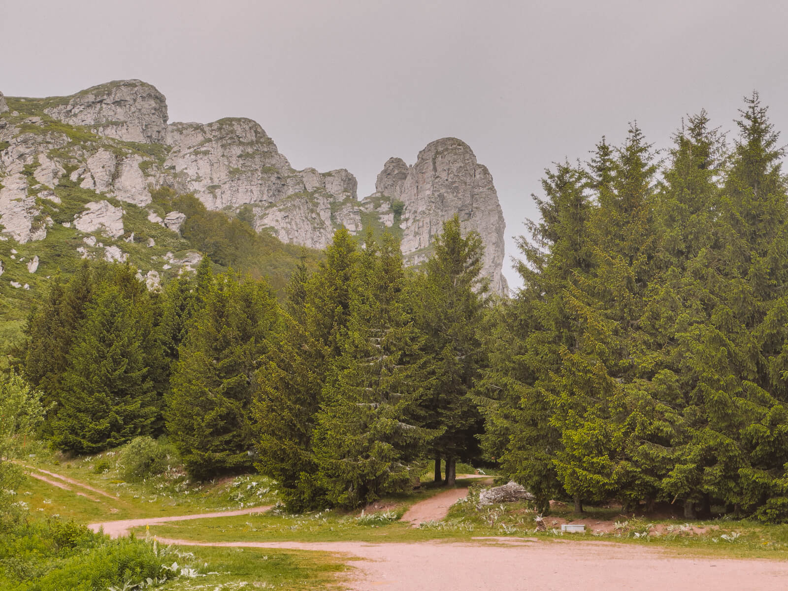
Hiking in Serbia's "Old Mountains"
The Stara Planina are part of the Balkan Mountains,which stretch between Serbia and Bulgaria. In fact, the majority of the mountain range is located in Serbia's neighbouring country, where the Balkan Mountains are already better developed for hikers. The Serbian side, on the other hand, is even more undeveloped, wilder, more pristine - and therefore promises a great experience, especially for lovers of nature and adventure holidays! Die serbische Seite ist dagegen noch unerschlossener, wilder, ursprünglicher – und verspricht deshalb besonders für Liebhaber von Natur- und Abenteuerurlaub ein tolles Erlebnis!
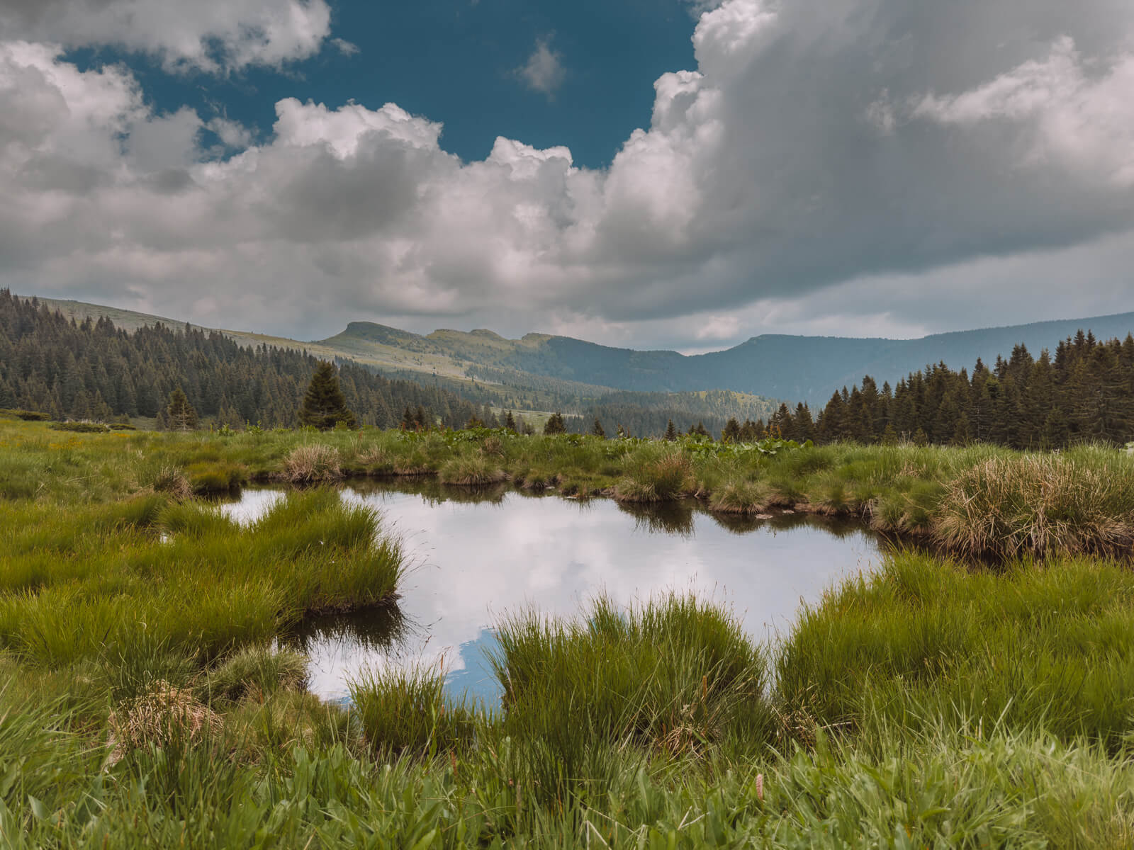
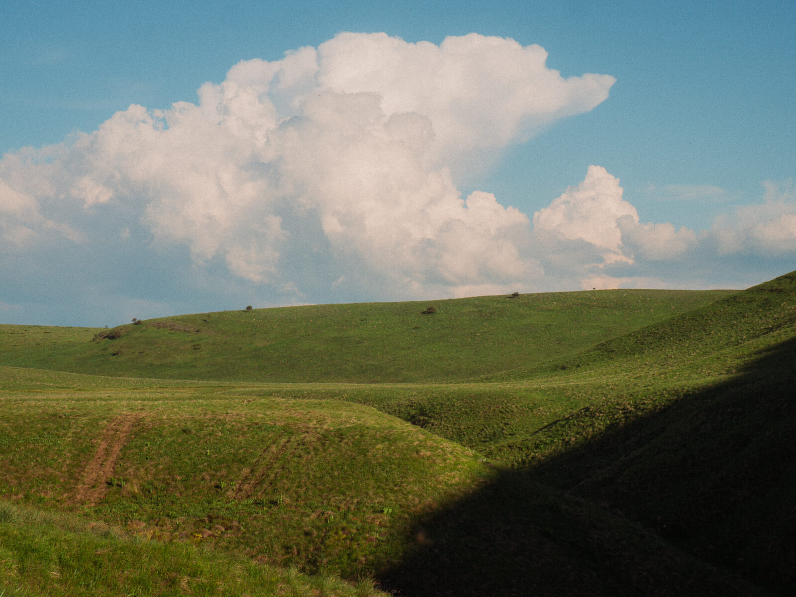
The old mountains: rolling hills, high peaks and endless expanses of mountain meadows, forests and unspoilt nature. Their valleys smell of wild thyme or mint, in the villages time stands still, the old stories and dishes are still celebrated. They are famous for how authentic they still are – and for their more than 70 waterfalls. The Stara Planina are between 1,100 and 2,000 metres high and the highest peak in Serbia, Midžor at 2,169 metres, lies in their midst.
Vorab: Alle Wanderungen auf dem Balkangebirge würde ich nur mit einem Wanderführer empfehlen. Sämtliche Aktivitäten wurden für uns von Nature Travel Office aus Niš geplant, deren Gründer Milan die Berge kennt wie seine Westentasche. Vor 12 Jahren war er der Erste, der mit den Bergsteigervereinen der Gegend begann, Wanderwege zu markieren und Touren anzubieten.
Day 1: Niš - Dojkinci via Samar Cave
My journey starts in Belgrade. I travelled to the Serbian capital the day before to cover the two and a half hour journey to Niš from there. Tamara from the Serbian tourism organisation drives the route with us by car - but if you don't have a hire car, you can also take the bus. The locals didn't recommend the train, as it's probably an eight-hour journey!
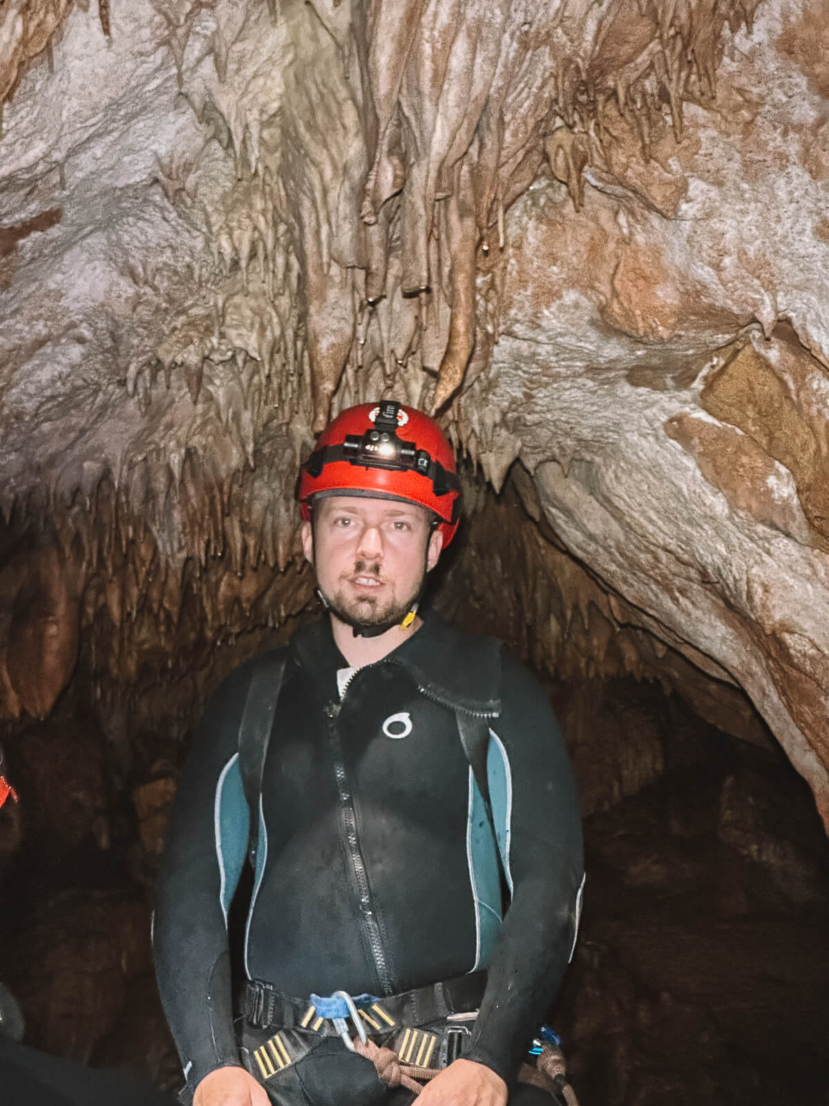
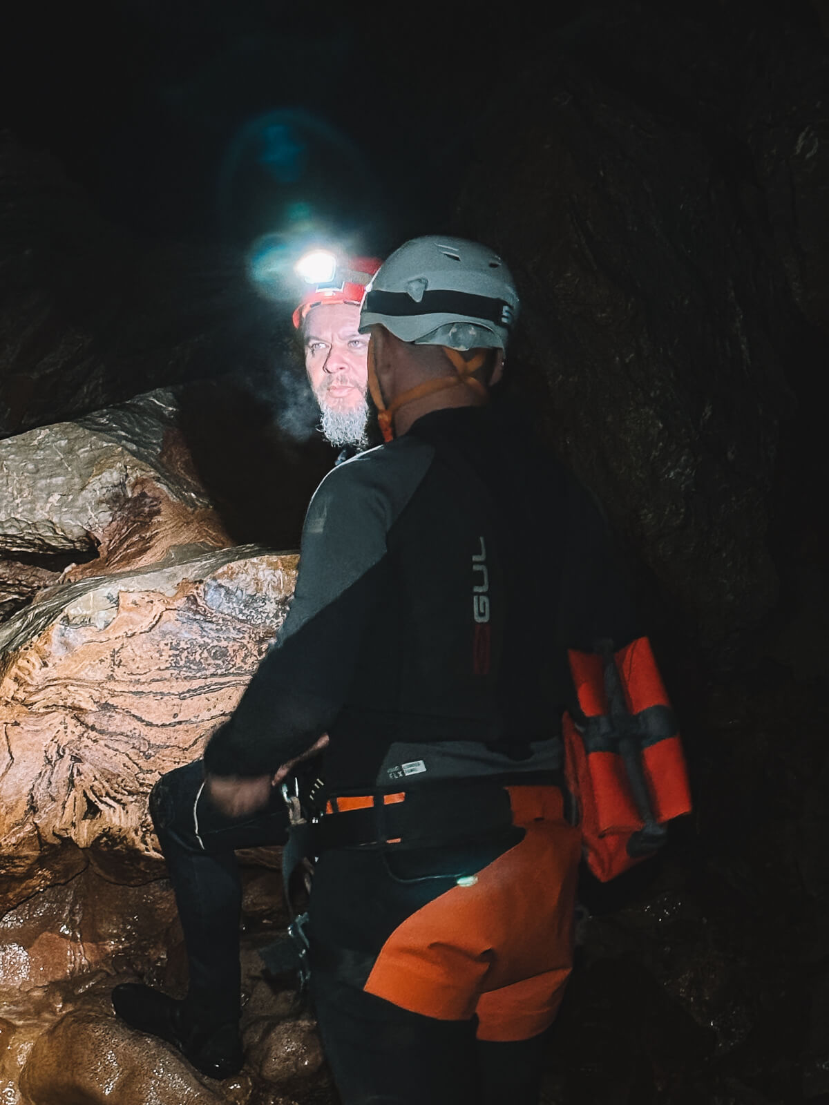
The first day of our hiking trip gets off to an adventurous start - and I'm about to reach my limits. But more on that in a moment. Today, our three guides are taking us to the Samar Cave, located on the slopes of Mount Kalafat. The special thing about Samar is that you can walk through the entire 3.5 kilometre-long cave.With a trained guide, of course - Samar is a "wild cave", which means that there are no commercially signposted paths or routes.
The natural monument was also home to Yugoslav cave explorer Milutin Veljković for 464 days, and there are even a few of his tins still lying around. I don't know how he managed that. Because just a few metres after we enter the cave and wade through the water, my anxiety increases.
For me, it feels more like being trapped in a mausoleum than an adventure and as we crawl on our knees and slide down narrow passages, I have to give up. Fortunately, guide Milan recognised my condition straight away and within 20 minutes I was back in the daylight. If you fancy this adventure more than I do (and don't suffer from claustrophobia), you can book it here.
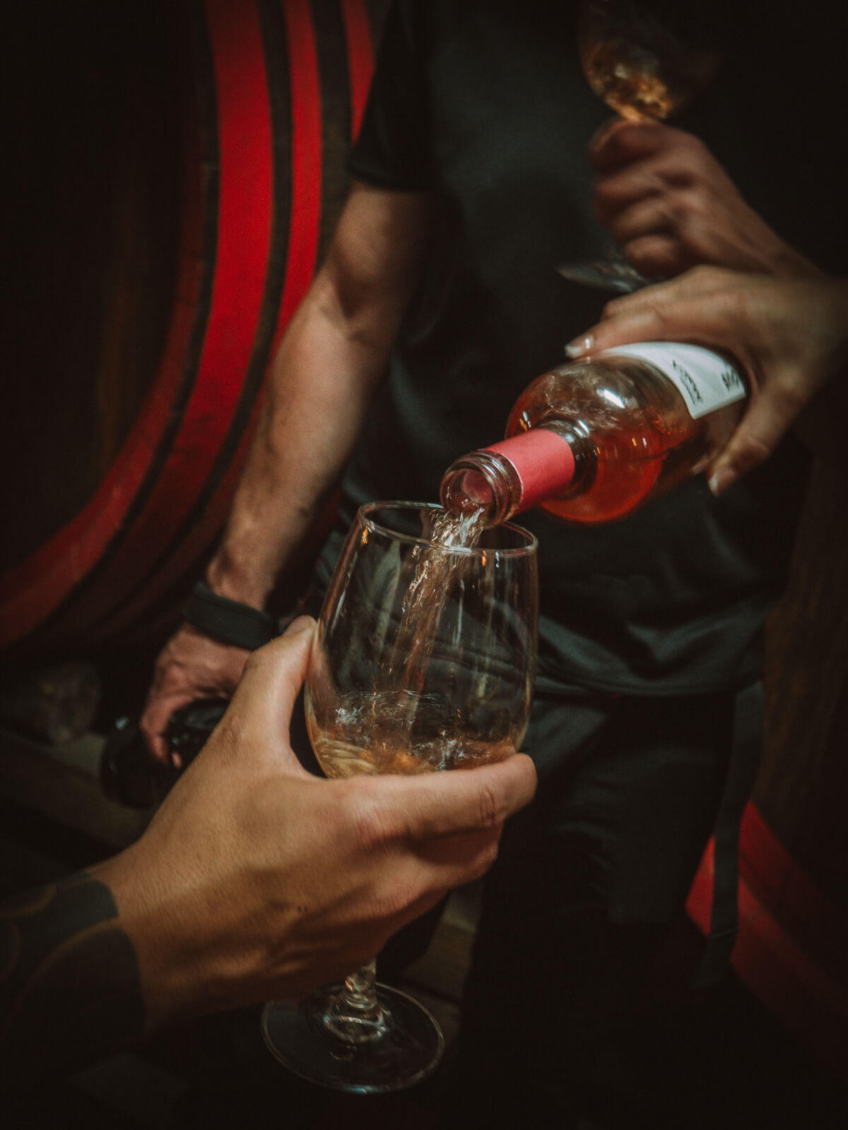
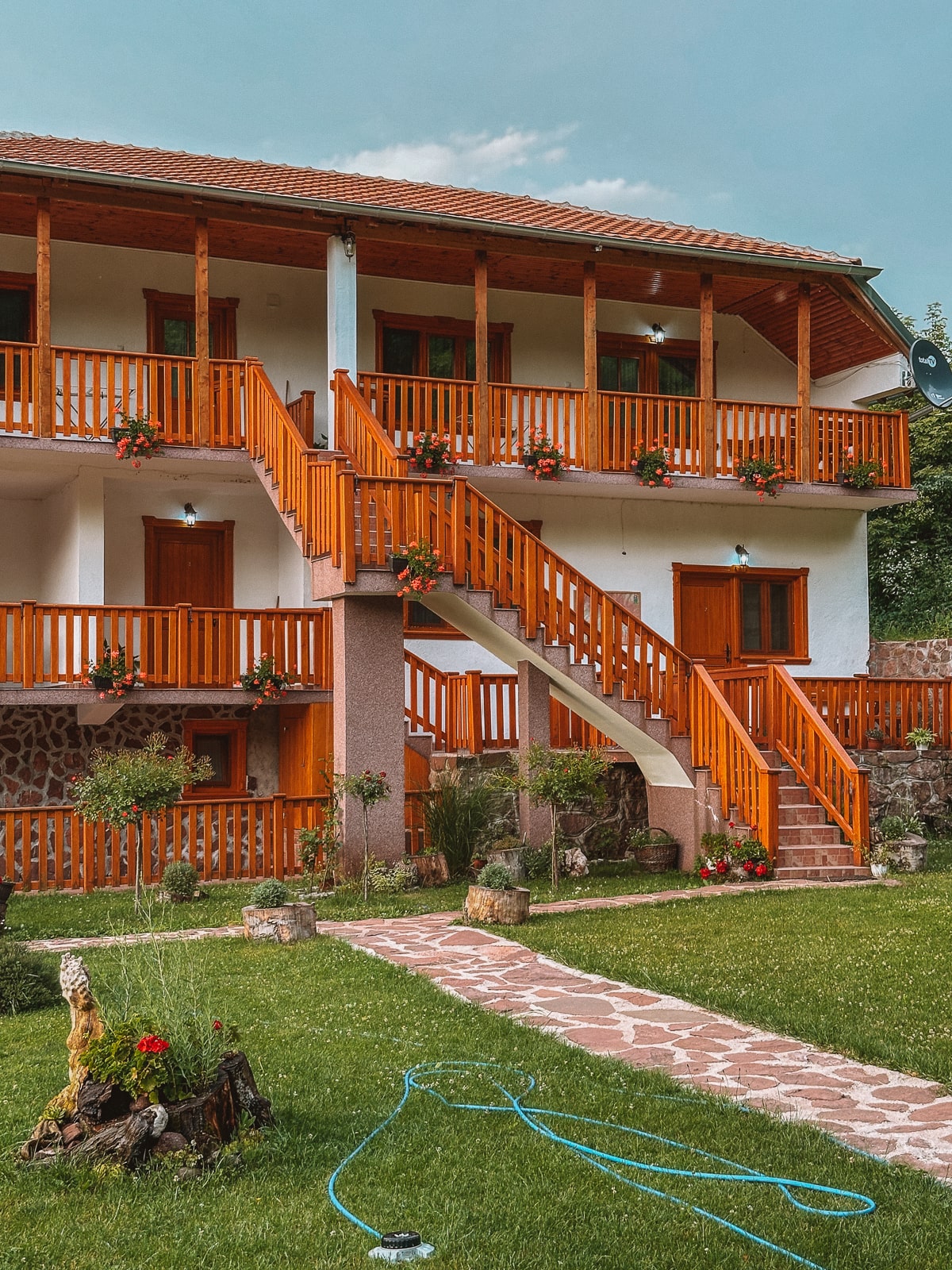
Fortunately, a visit to Malča winery, awaits me straight afterwards. And after a warm meal and a wine tasting, my good mood is restored. We are ready for the drive into the old mountains, more precisely to Dojkinci, a mountain village at 800 metres. Once we arrive at our accommodation for the night, the Planinarski Dom Dojkinci, I just fall into bed. The adventure has completely exhausted me!

Day 2: Waterfalls around Dojkinci
The first thing I notice when I wake up is the sound of water. Last night I didn't bother to look around and fell straight into bed. But now I realise that the mountain hut where we are staying is right next to a small river. The Planinarski Dom Dojkincis brand new, the rooms are cosy and when I come downstairs, the owner immediately asks me if I would like a coffee. Absolutely!
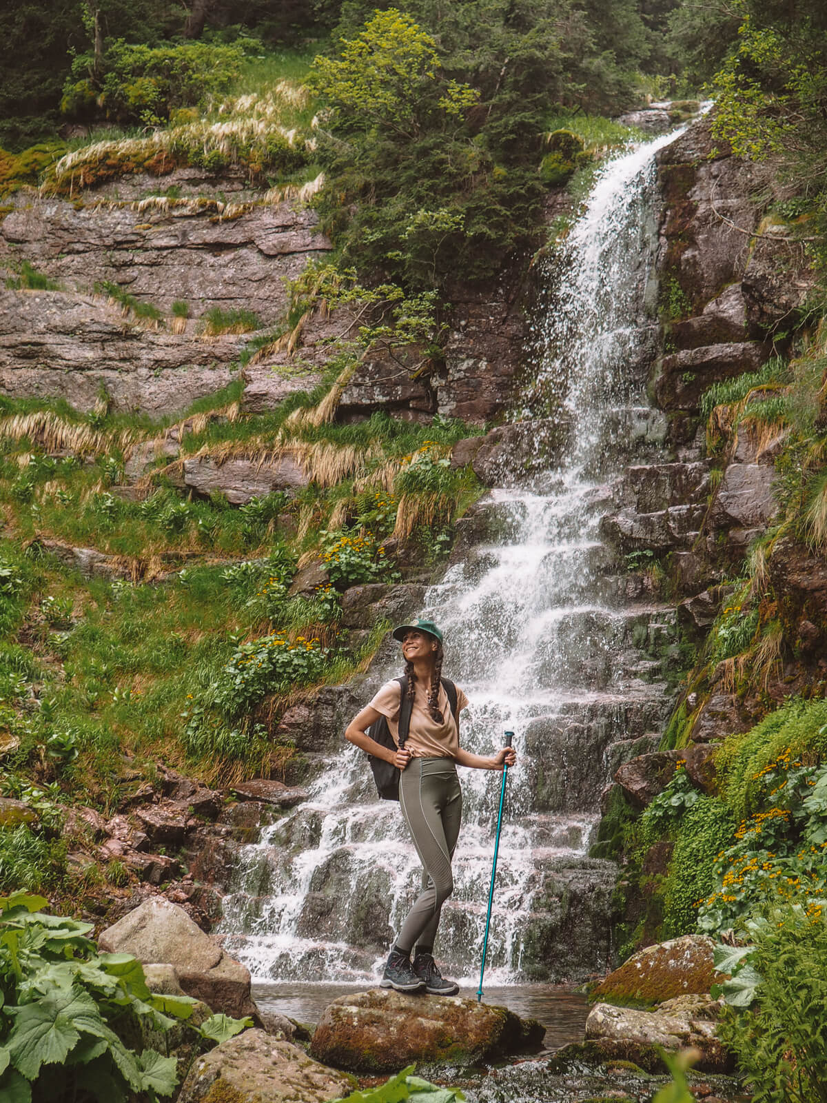
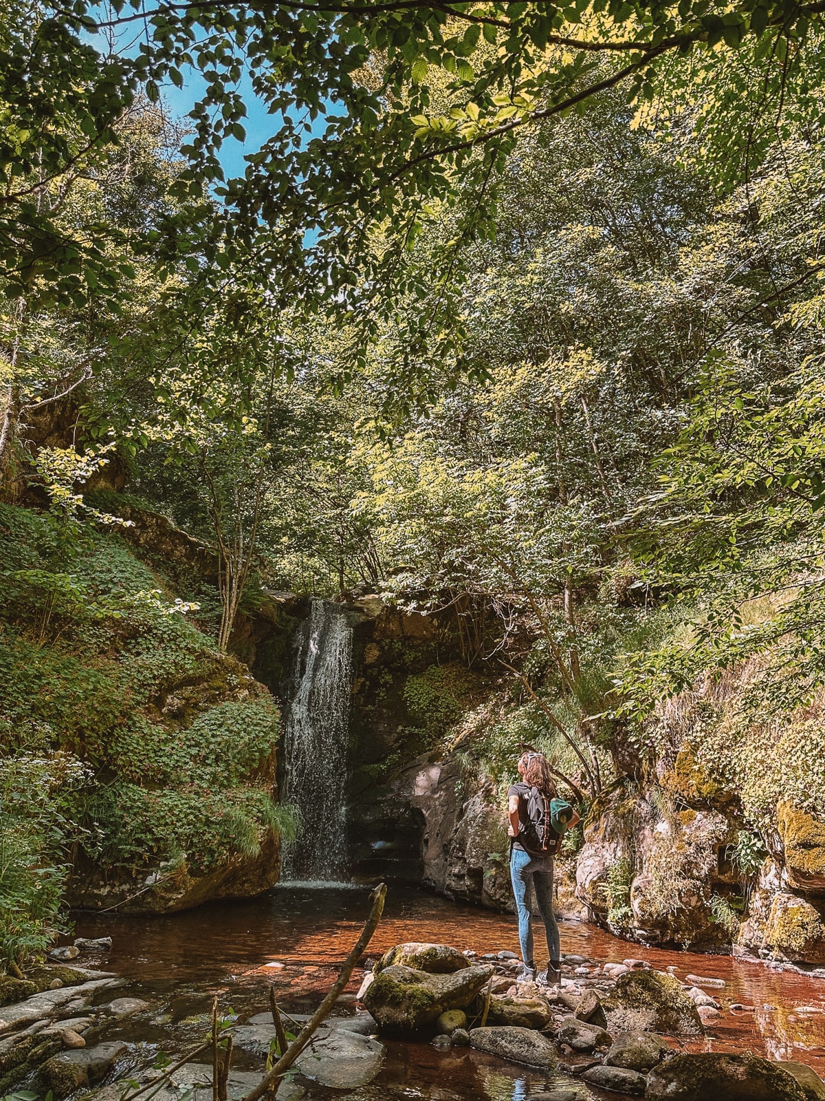
Arbinje waterfall
After an excellent breakfast at Restoran Vrelo , we set off in jeeps to the starting point of today's hike: the Arbinje waterfall, sometimes also known as the 3-fountain waterfall. Theoretically, it would also be possible to start the hike directly from Dojkinci, but we want to see more today - so we cut it a little short. Arbinje-Wasserfall, manchmal auch 3-Brunnen-Wasserfall genannt. Theoretisch wäre es auch möglich, die Wanderung direkt von Dojkinci aus zu starten, aber wir wollen heute noch mehr sehen – also kürzen wir ein wenig ab.
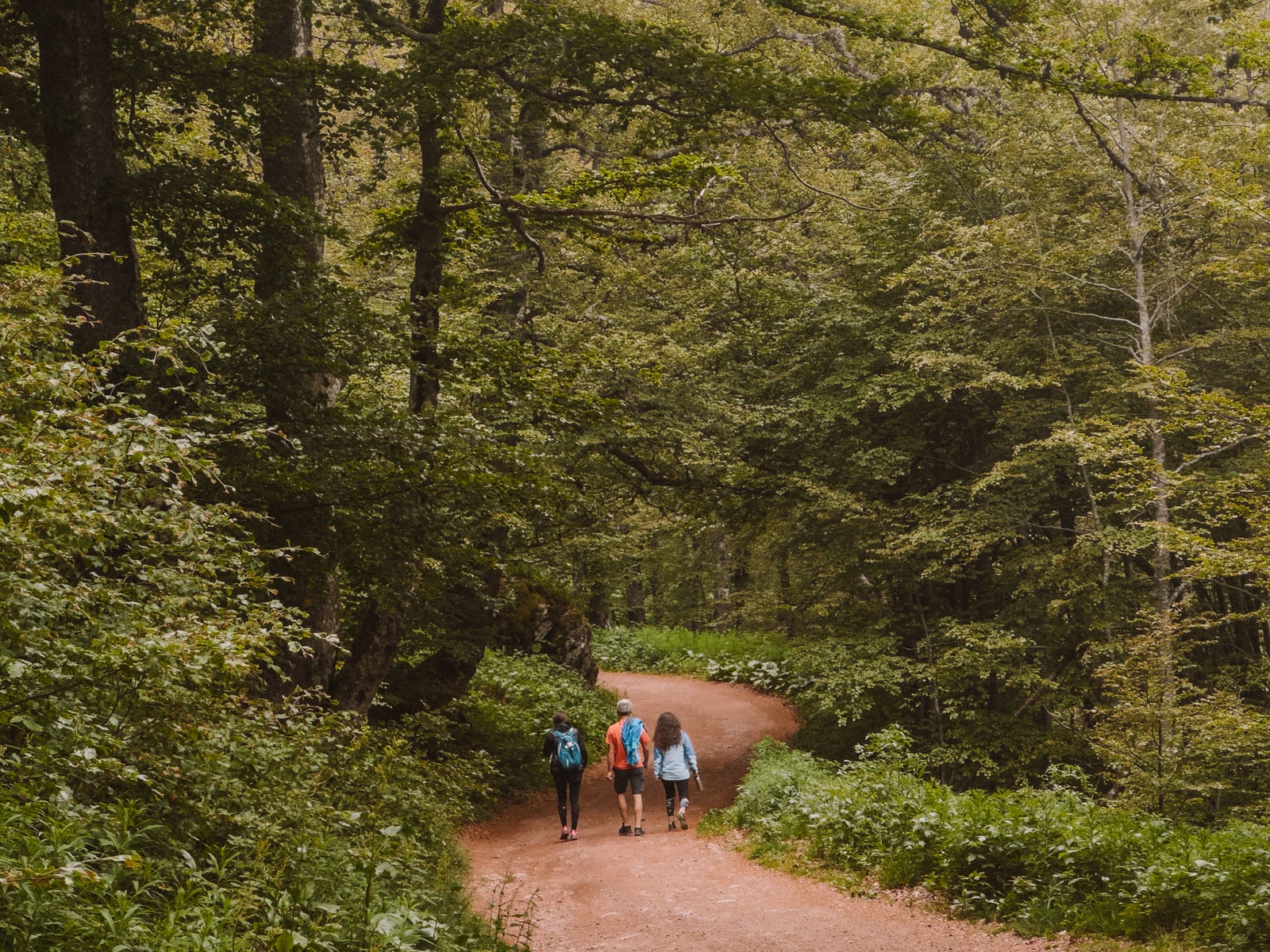
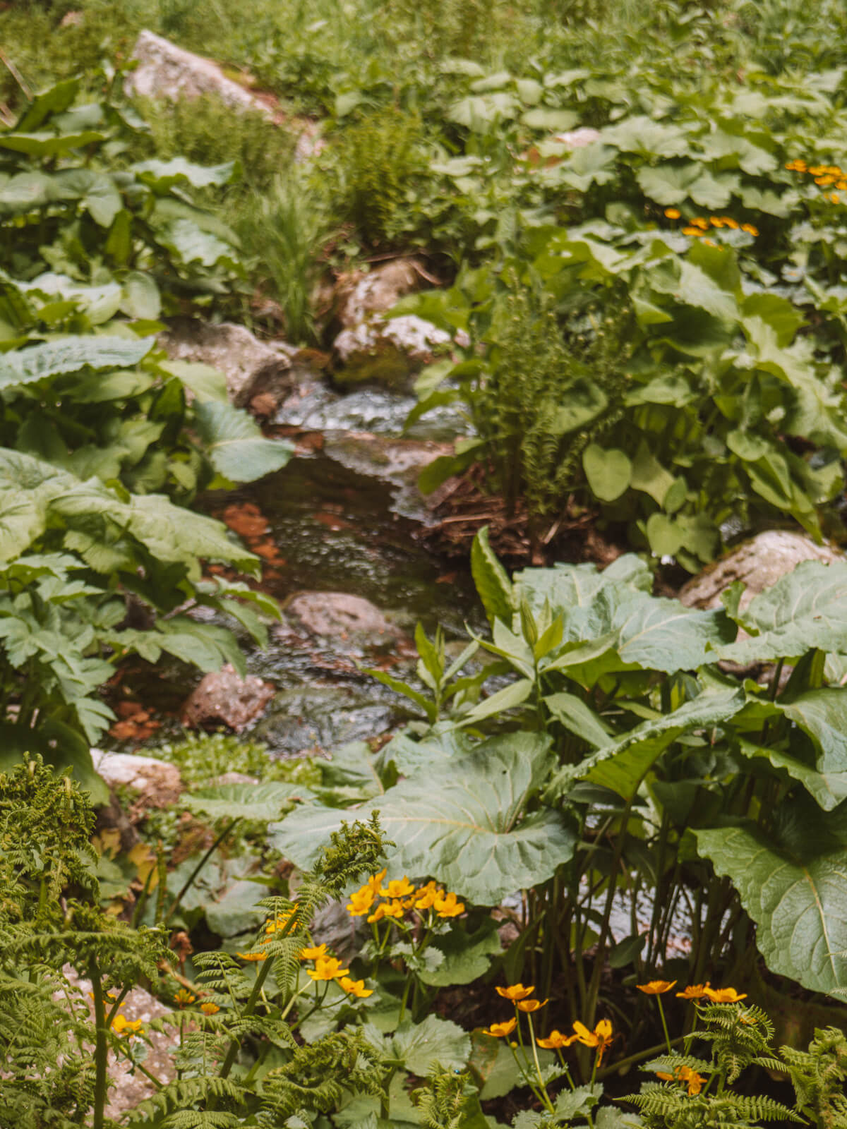
Our moderate hike to the waterfall takes around 45 minutes, through a landscape that reminds me of Jurassic Park. The path is signposted, albeit patchy, and we don't see another soul. Again and again we cross and recross small streams, the plants along the way are lush, a veritable jungle!
And we all stop for a moment in awe when the waterfall finally appears in front of us with its impressive cascades . This is always one of the most wonderful moments for me - when the finish line appears after all the effort! And when it's as impressive as this paradise, all the effort is immediately forgotten.
Starting point of the hike:: Google Pin (only accessible by off-road vehicles)
Finish point of the hike: Google Pin
Length: approx. 4 kilometres
Elevation gain: 160
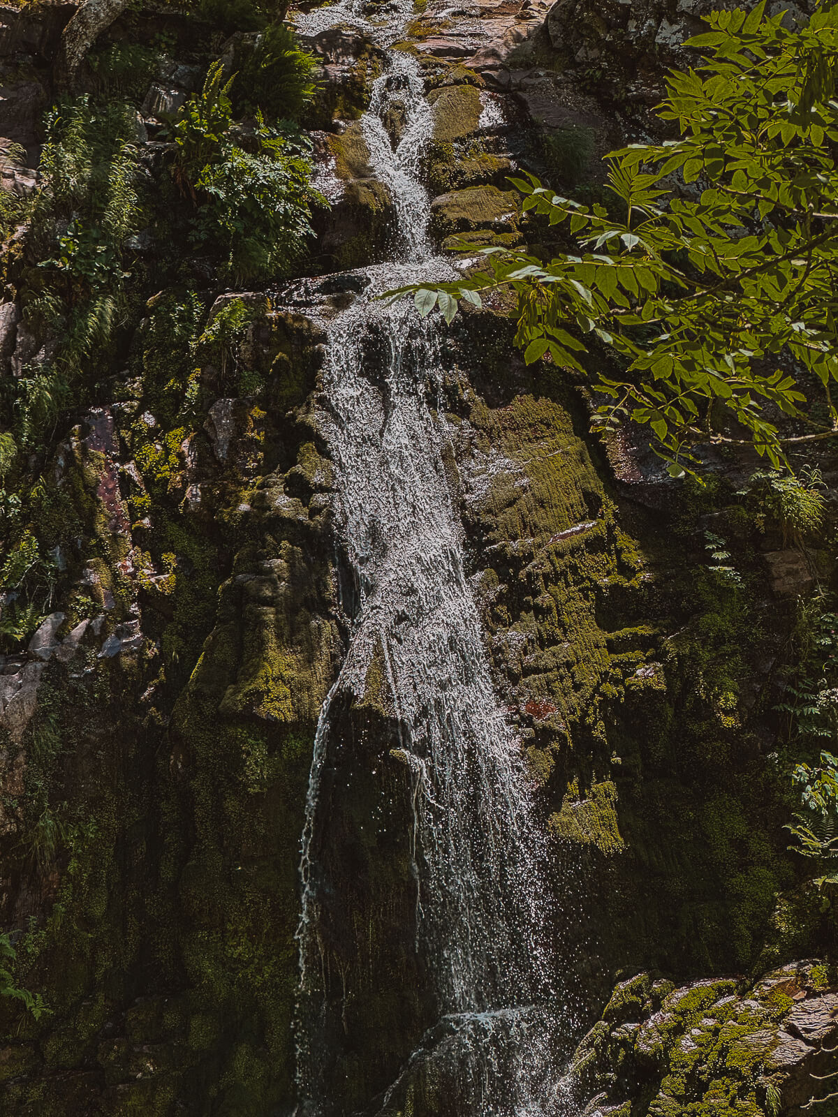
Tupavica waterfall
After a hearty lunch (nothing tastes better than eating the simplest meal with your fingers after a hike right by the river, right?), we set off for the next waterfall: The Tupavica waterfall.
The 50 metre-high waterfall is just a short walk from the road and is a real beauty! The water literally flows down the cascades like a curtain - the Tupavica waterfall is said to be even more beautiful in winter when it freezes completely!
Ponor karst cave
The Ponor karst cave The Ponor karst cave is the last impressive stop of our day . This natural beauty can be reached from Dojkinici by jeep or on a 6-hour hike. We make the short journey in half the time by jeep, on the paths that the shepherds of the region have been using for ages to transport provisions to the mountains and sick animals to the towns.
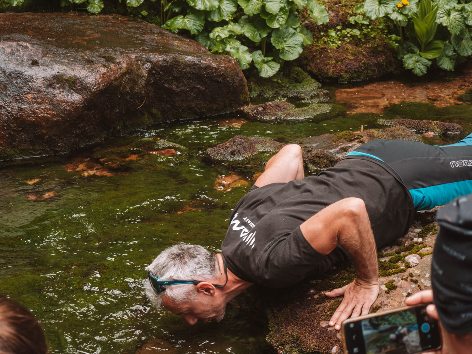
At around 1,500 metres, masses of water have dug a deep hole over the centuries, in which a waterfall is hidden. Only on closer inspection do you recognise it in the deep opening - an unreal place that should be enjoyed with due caution because of the steep, slippery descent. We enjoy a late coffee here before heading back to Dojkinci.
Day 3: Up Vražija Glava, the Devil's Head
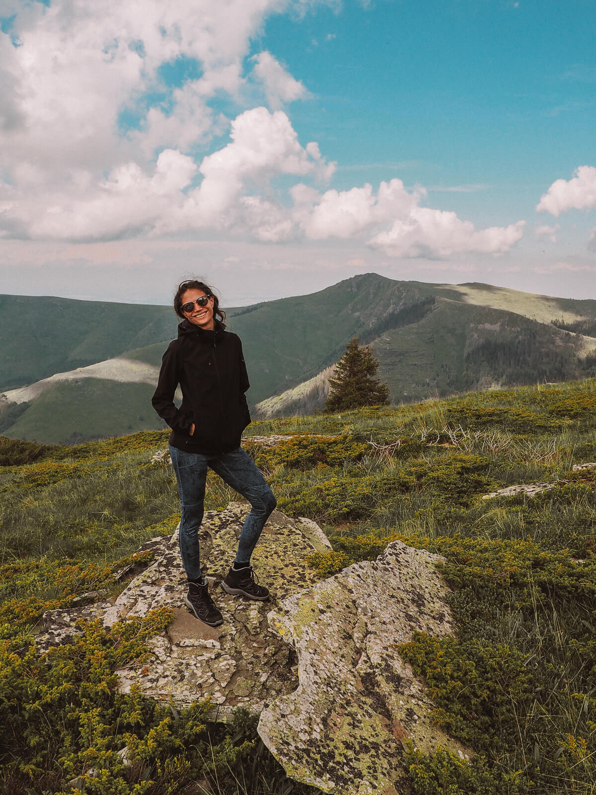
Today is a hike I've been looking forward to: We are climbing the Devil's Head, on the border between Serbia and Bulgaria, at 1,935 metres . From our starting point, which is accessible by off-road vehicle, it's only around three kilometres in total - but it's a tough one!
As we hike, we fight our way through stubborn juniper bushes that have now almost swallowed up the hiking trail. Fortunately, our guide Milan, one of the first people to mark hiking trails on the Stara Planina, knows his way around and jumps from stone to stone like a chamois. The rest of us try to keep up and I keep looking down at the Bulgarian villages deep below us. How cool to be here on the border of two countries, without any traffic jams or border fences!
Once at the top, we enjoy the summit all to ourselves for a few blissful minutes before a hiking group from Bulgaria arrives and it gets crowded on the summit. This is our signal to set off - at exactly the right moment, because as we reach the jeeps, summer rain starts to fall in thick drops.
Starting point: Beledje, 8QJV+QH, Dojkinci, Serbia (check my AllTrails Map)
Length: ca. 3 Kilometer
Elevation gain: 200
Tip: If you are hiking alone (please only as an experienced hiker), then I recommend the mapy.cz app for this area. The usual apps won't help you much.

Vrtibog - living in a Windows 98 desktop
As the rain slowly subsides, we reach Vrtibog - a karst plateau at an altitude of 1,400 metres. The area is still used for livestock farming today.
And in the middle of the mountain, we suddenly hear loud music. A family of shepherds is just settling in for the summer. They spend five months of the year here with 150 animals. Life is pristine, simple and hard. When we arrive, the cows are being milked, fresh cheese is being made and, of course, we can't drive on without having an obligatory rakija with the host.
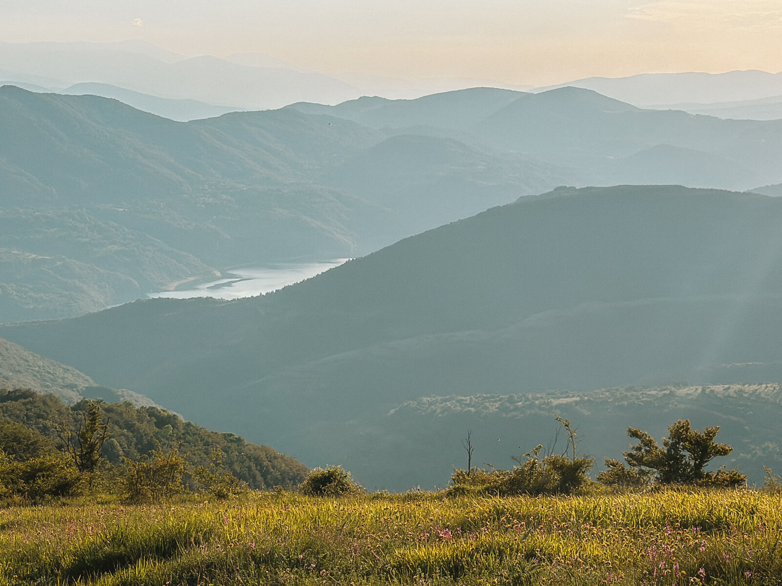
We drive through a Windows desktop background as the sun casts golden light on the mountain meadows full of wildflowers and butterflies dance through the warm air. The day ends with a view of Lake Zavoj glistening in the sun deep below us. There couldn't be a more romantic sunset!


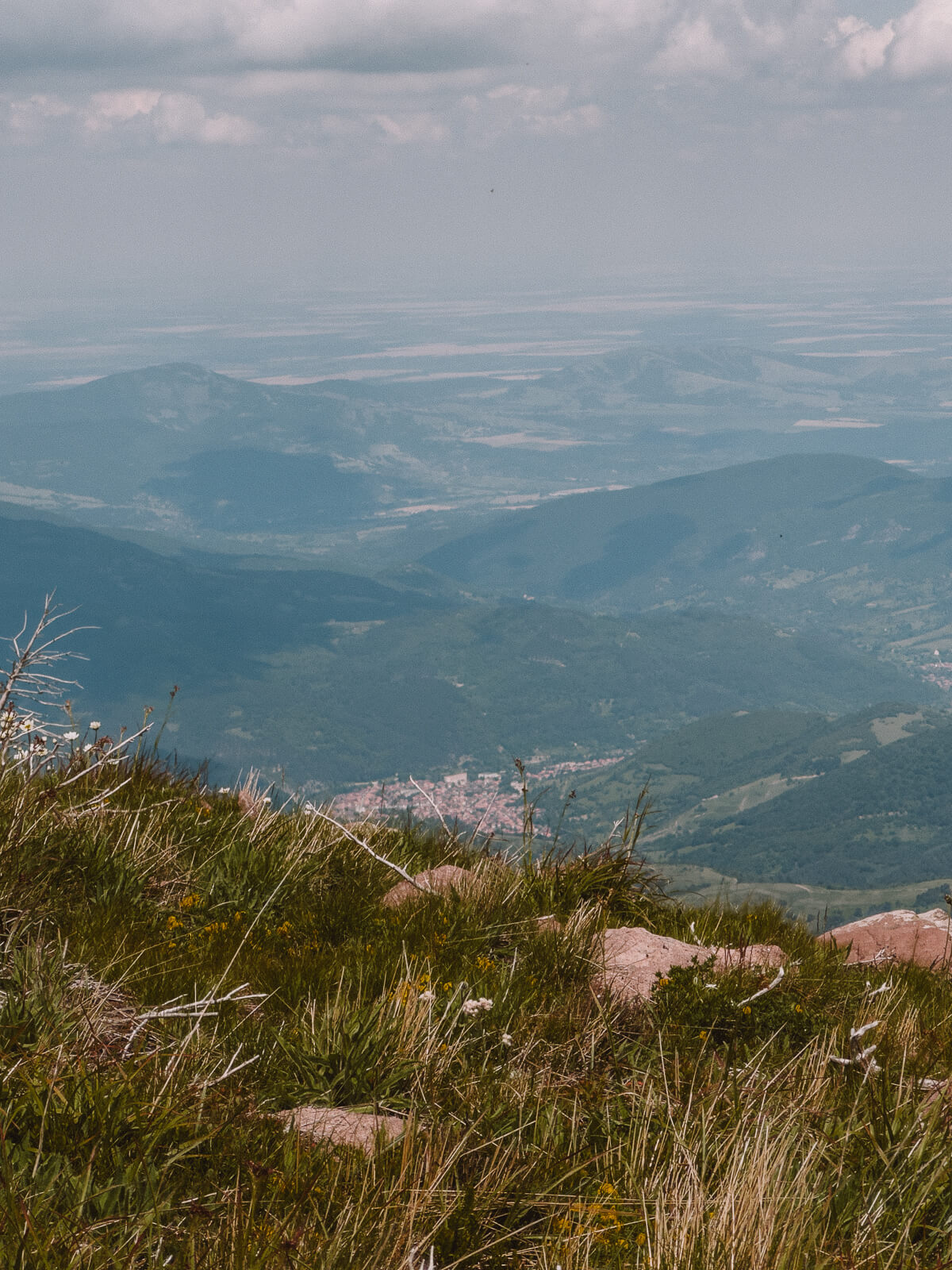
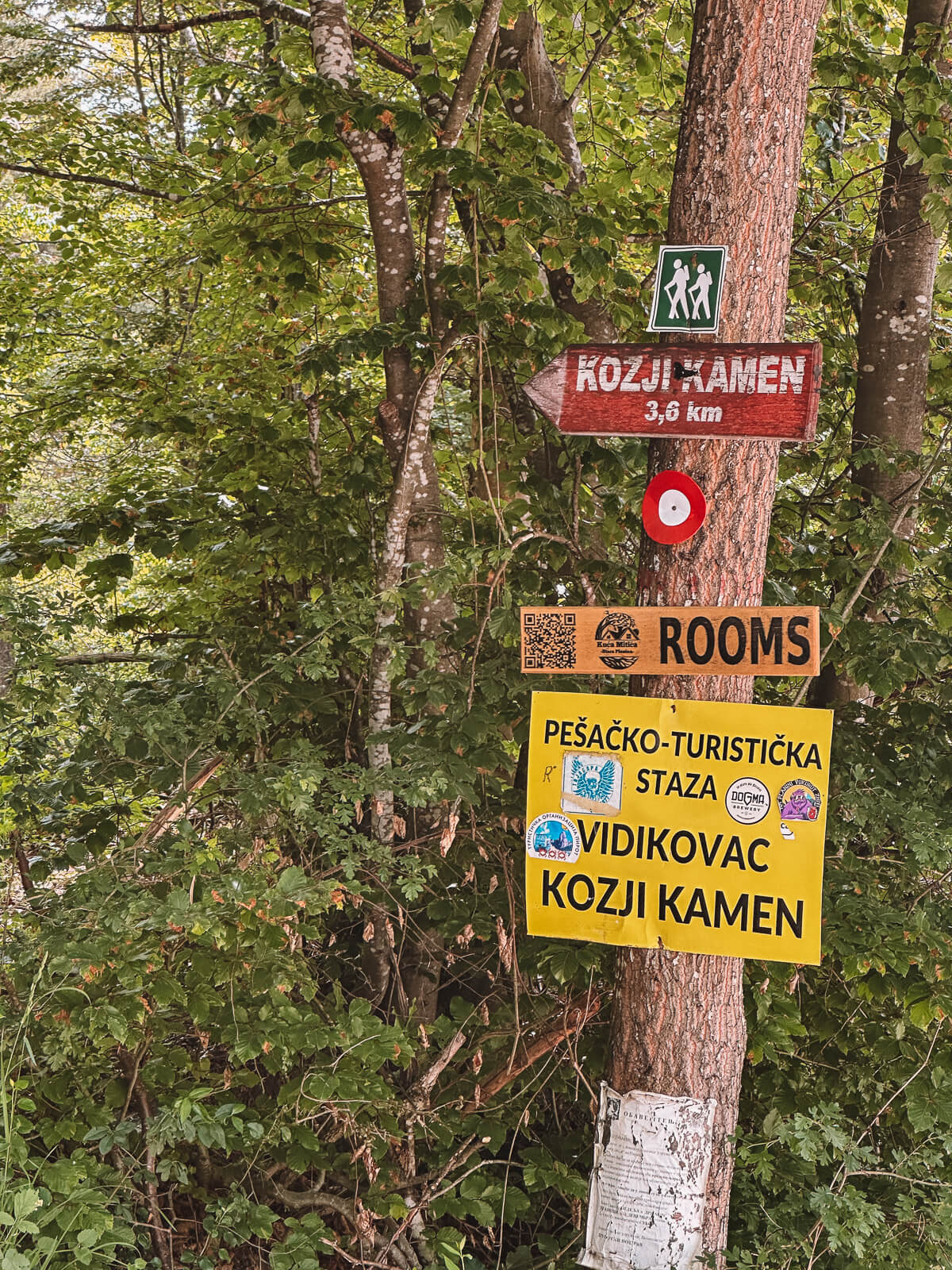
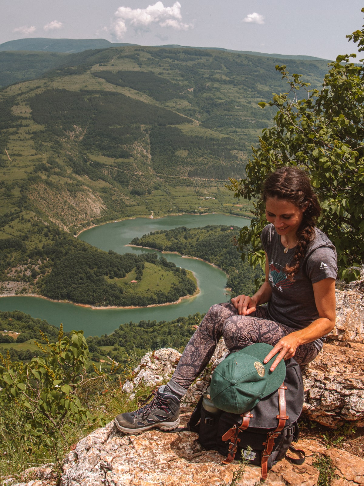
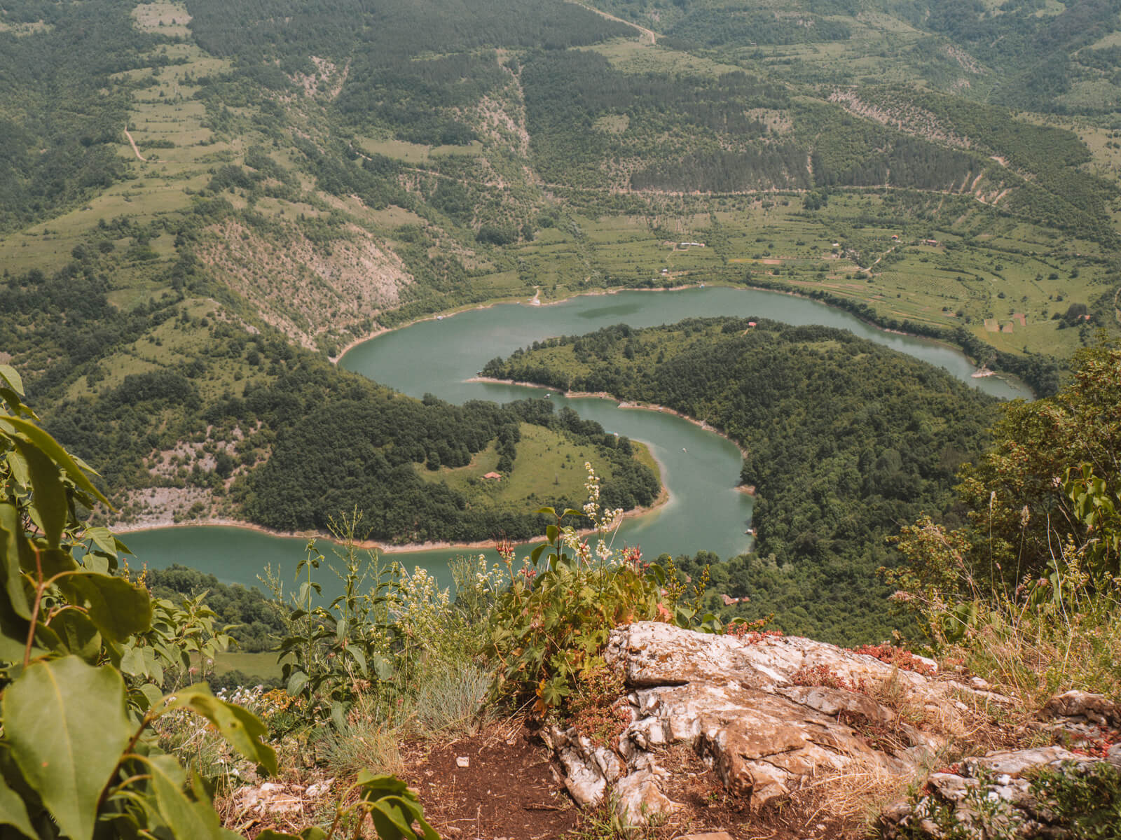
Day 4: Up the Kozji Kamen
The The Kozji Kamen viewpoint is one of the most famous of the Old Mountains . From here, you can look out over the emerald green meanders of the meandering Visočica River and the mountain peaks in the background.
The proximity to the town of Pirot makes the view of the gorge a popular excursion destination and photo motif, also because the hike, which is around six kilometres long, is not too demanding.
At lunchtime, we still have the viewing platform almost all to ourselves as we enjoy a cosy coffee. Today it's also time to change accommodation. We spend the next few nights in the village of Topli Do on the other side of Stara Planina - to discover something new there once again.
Day 5: The waterfalls of Topli Do
Is today supposed to be our last real day in the old mountains? We are all a little wistful at breakfast. No wonder - Topli Do really is an oasis and the mountain hut Kuća Stojanovića, where we are staying, spoils us with good food, a cosy garden and a breakfast where we sit almost directly on the riverbank with a view of the mountain slopes - strangely enough, everything here reminds me a little of Berat in Albania.
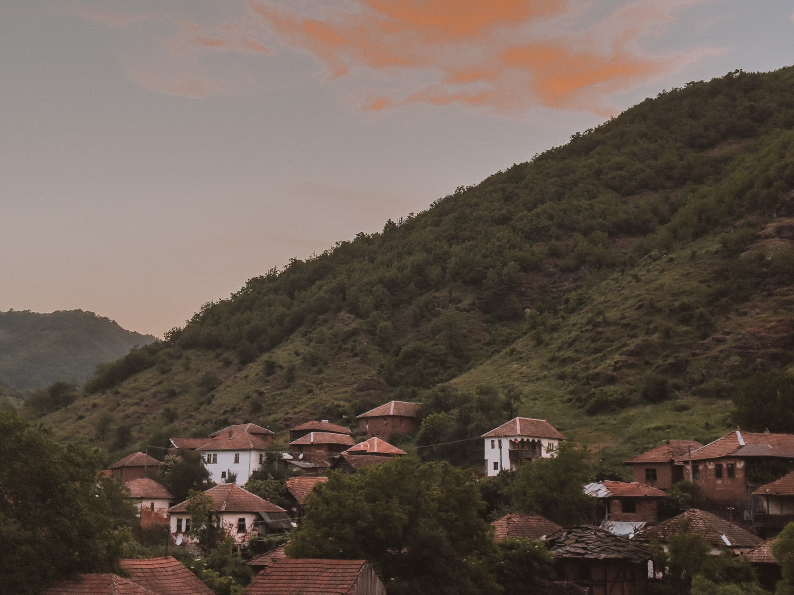
Topli Do is considered one of the most authentic mountain villages on Stara Planina , with buildings typical of the region, and the drive through the canyon of the Temštica River earned it the name "Little Colorado". And with the multitude of waterfalls and rivers and the characteristically red soil, I even believe this nickname!
The flora and fauna here seem to be even more pristine, even richer than around Dojkinci - the size of the plants is impressive and the abundance of water seems to drive nature to peak performance. I feel as if T-Rex could turn the corner at any moment as we drive our jeep over the bumpy gravel tracks while Eros Ramazzotti blares from the loudspeakers.

Upper and lower Kurtulski waterfall
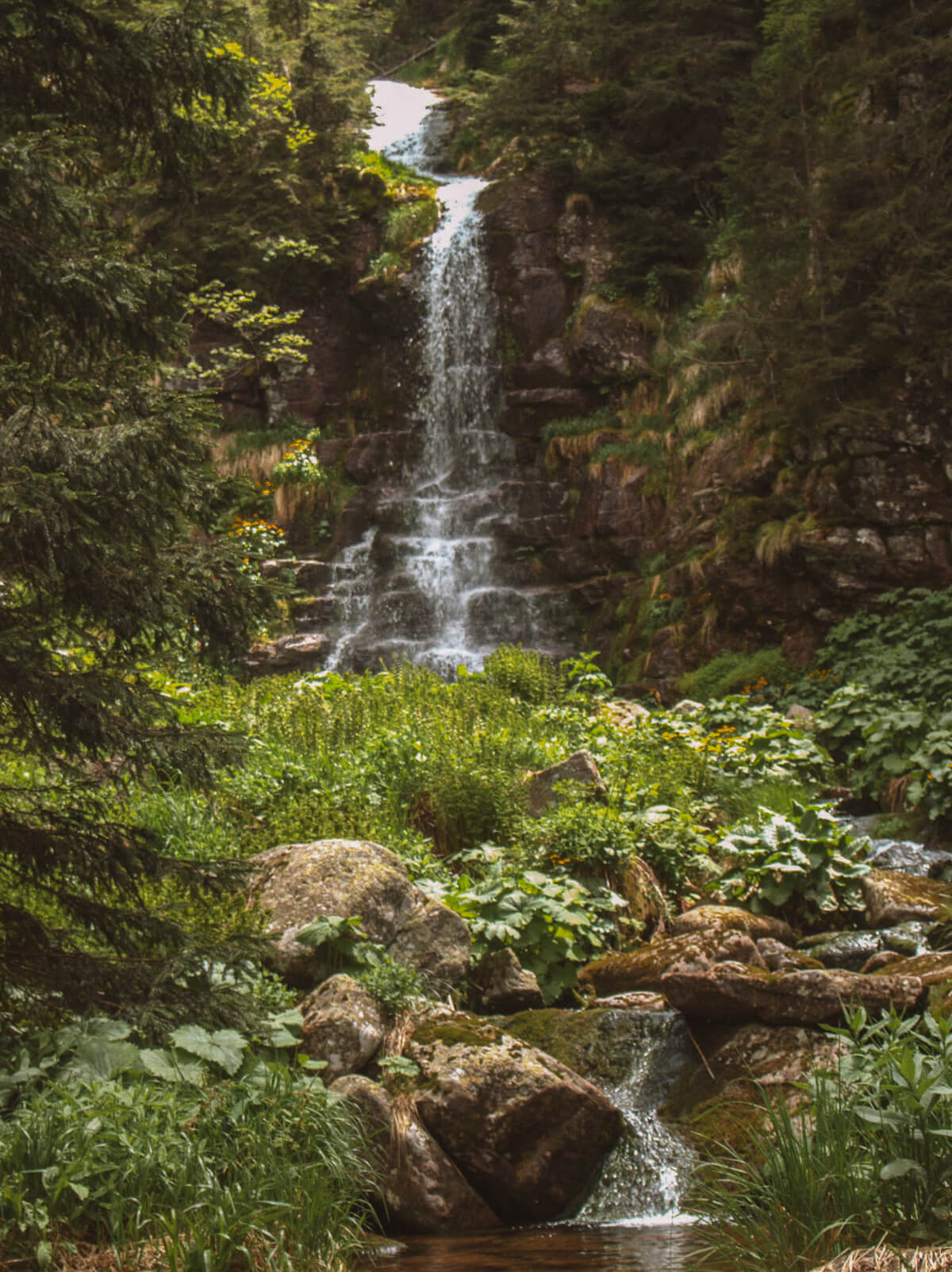
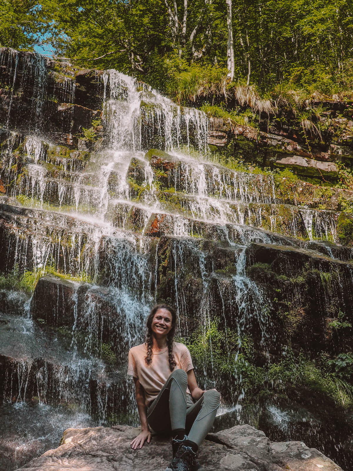
Around eight kilometres from Topli Do, the first sight awaits us, the 27 metre high Kurtul waterfall. As we want to visit several waterfalls today, we don't walk the whole route, but only about two kilometres to the upper and lower Kurtul waterfalls.
Both are impressive, but if I had to choose, I actually like the lower Kurtul waterfall, the smaller one, a little better. It is romantically situated in the forest, with a small pond where we refresh ourselves with a dip in the cool water, completely alone in this dreamy place.
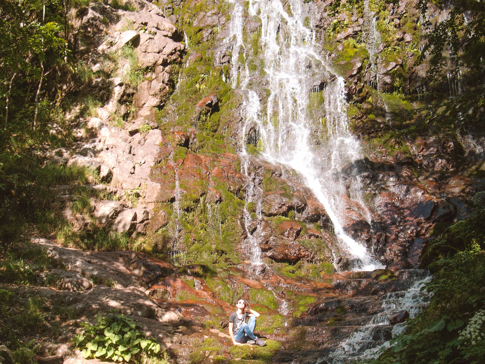
Cunguljski waterfall
The next route is a tough one: just one kilometre long, it climbs steeply over hill and dale to the Cunguljski waterfall. The water cascades 43 metres over the mountainside like a curtain, and we can't even guess the mountain ranges from which it originates due to the dense flora and fauna all around. Our energy reserves are also slowly being used up here - we are exhausted, even though there is another waterfall to come. A good level of fitness is definitely a must for anyone who wants to go hiking in the ancient mountains.

Piljski Waterfall
Is it really worth seeing? My colleague Ana and Lara want to know and I also consider skipping the last stop. But when Aleks unpacks a photo of the Pilijski waterfall, we mobilise our last reserves. We have to see it!
About four kilometres from Topli Do lies the 64-metre-high waterfall - and it really is one of the most beautiful I have ever seen. Embedded in the mountain slopes, the water pours down into the depths, creating little streams and once again impressive flora and fauna.
We fill up our water bottles - the water here is safe to drink - and toast to a successful week of hiking. This seems like the perfect place for it!

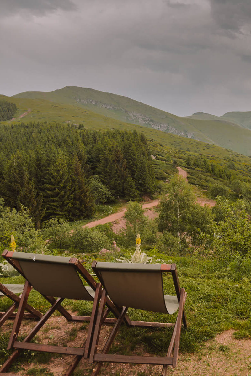
Day 6: Babin Zub and Belgrade
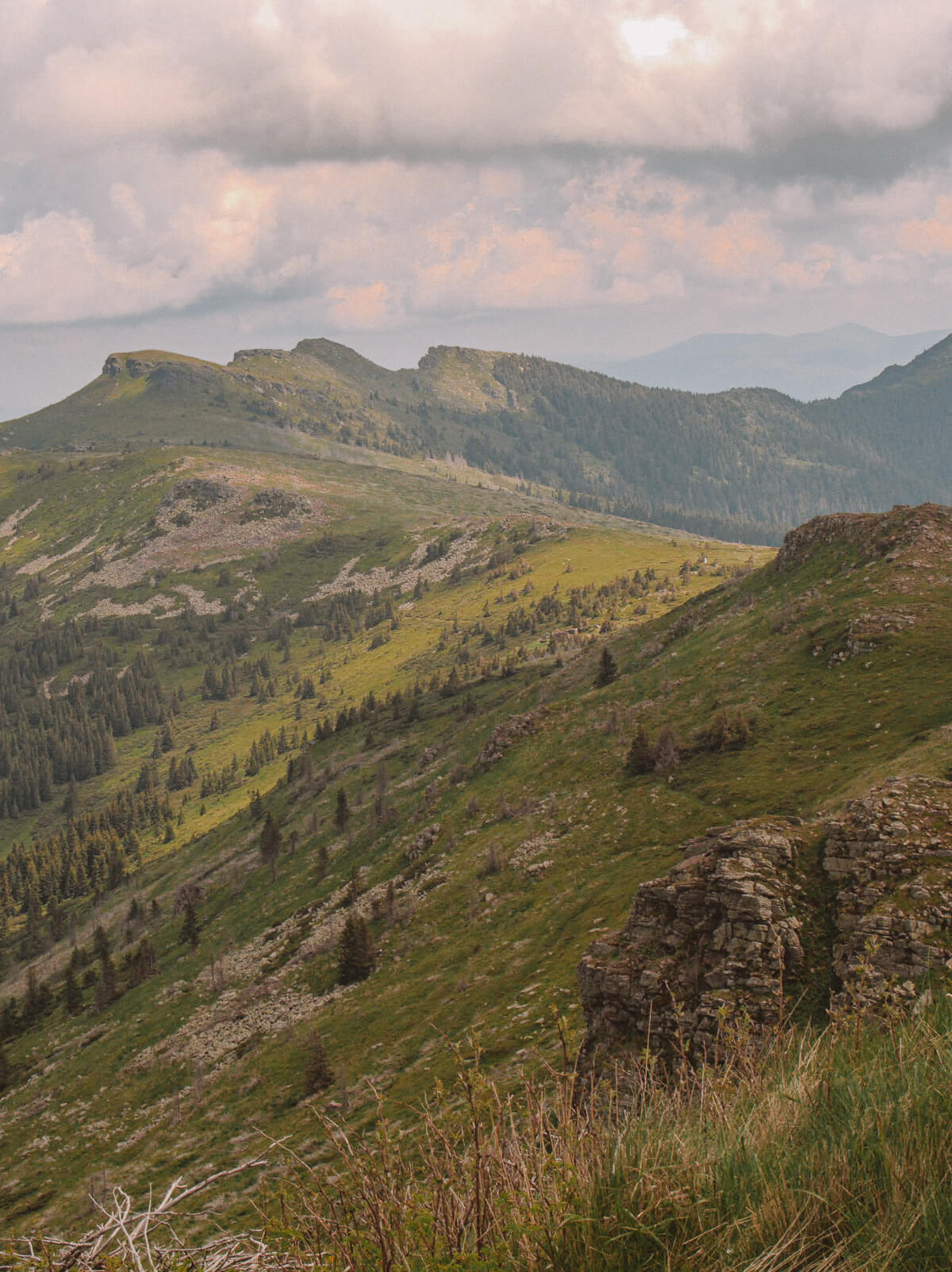
Our journey is coming to an end - today we are travelling back to the capital Belgrade. Of course, we can't leave the area without seeing the highest peak of the Balkan Mountains on the Serbian side, Midzor, at least once. The clouds are hanging low as we pass the closed ski resorts of Babin Zub and order a coffee at the only open restaurant.
We take another look at all the mountain ranges we have been able to explore over the past few days. We won't be climbing the highest peak today, our feet are tired. But our fingers are still itching. Although we agree: We need a reason to come back to the Balkan Mountains.
Wildflowers bloom on the mountain slopes, the old mountains bid us farewell once again with the most beautiful panorama. And then, just as the last sip of coffee is drunk, the rain starts to fall. It seems that we are not the only ones finding it difficult to say goodbye to Stara Planina.
And I hope that you too might now have Serbia on your radar for your next trip to the Balkans! For all the tours I did in the Old Mountains, I can only recommend the travel agency Nature Travel Office from Niš warmly - I felt one hundred per cent at ease with their professional, funny, attentive guides at every moment and the love for the mountains definitely spread to all of us!

Frequently asked questions about hiking holidays to Serbia
Where to go hiking in Serbia?
Guided hikes in Serbia or going it alone?
I can only speak for the Balkan Mountains, but I would actually prefer to set off with a trained and experienced mountain guide. The markings for the hikes are not always clearly visible, the terrain is sometimes challenging and many starting points are only accessible by off-road vehicles. There is only a network in a few places. But if you are an experienced hiker, download mapy.cz for the best routes.
Hiking in Serbia: How to get there?
Depending on where you want to go, you can fly to Belgrade or Niš. Fruska Gora is easier to reach from Belgrade, as is the Tara National Park. The Balkan Mountains are around two hours away from Niš. You can also fly to Skopje, for example, and then take the bus to Niš.
The best time of year for hiking in Serbia
May and June and September and October are good months for outdoor activities in Serbia. Serbia is located in the centre of the Balkan Peninsula and has a continental climate, in western Serbia it is a little more Mediterranean with pronounced winter rains. I personally liked June best, when the wildflowers are in bloom and the mountains are splashed with wonderful colours.
I was invited by the National Tourism Organisation of Serbia (NTOS) and this article was written as part of this cooperation - but my opinion is unaffected by this and my enthusiasm for the Old Mountains is one hundred per cent genuine.